Surfaces
ResInsight is capable of mapping properties and simulation results onto 3D surfaces imported from GOCAD and Petrel as specified below.
Import and appearance of surfaces
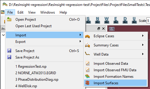
3D surfaces from GOCAD, Petrel and RMS are imported into ResInsight by the menu option File->Import->Import Surfaces in the 3D Main Window.
Surface file formats are described in Surface Data
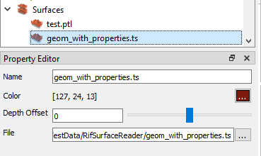
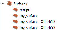
Imported surfaces are listed under the
 entry
in the Project Tree. You can click on a surface to change i.e. the name or color of the surface, or change the file to read the surface data from.
entry
in the Project Tree. You can click on a surface to change i.e. the name or color of the surface, or change the file to read the surface data from.
You can also change the depth of the surface by adding a depth offset (positive or negative). This could be used i.e. to import the same surface file multiple times and assign each instance of the surface a separate depth offset. When a depth offset is set, the offset value will be shown as part of the surface name in the project tree.
Note
Multiple surfaces can be imported at the same time by choosing more than one input file in the file selection window that shows up when you start an import.
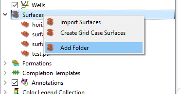
Using folders
To make it easier to organize the surfaces you import into your project, ResInsight supports creating surface folders in the project tree. To create a new folder, right-click on the top level Surfaces folder in the project tree and choose Add Folder.
Surface Results
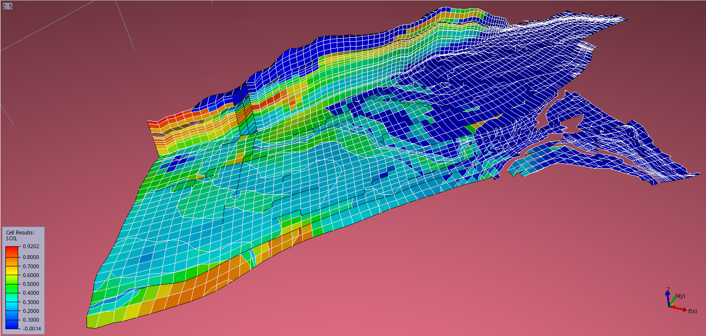
Per default, ResInsight maps current Cell Result on a given surface. If another result is to be displayed, specify the result under Surface Results as shown below.
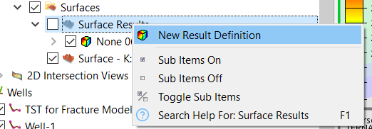
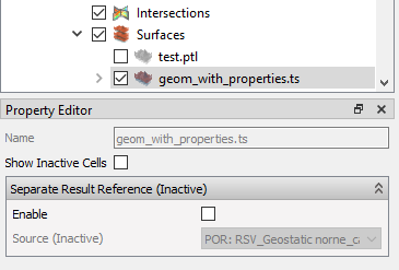
Clicking a surface of a View in the Project Tree activates the Property Editor for allowing view settings as shown below.
To change result displayed on the surface, please specify the desired result in the Result Reference section of the Property Editor.
Surface Display Mode
When a surface cuts through a grid model, result values are mapped onto the surface geometry. Areas of the surface that fall outside the grid model are colored using the surface color. To avoid z-fighting and visual noise caused by overlapping geometries, the display mode can be controlled at both the surface collection level and per individual surface.
The following display modes are available:
- Surface – The surface is drawn using a single uniform surface color
- Results – The surface is colored using mapped result values only
- Both – Both the surface color and result colors are shown (default)
The display mode can be set on the top-level Surfaces folder in the Project Tree to apply to all surfaces, or overridden per individual surface in the Property Editor.
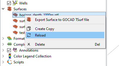
Reloading Surfaces
If you have modified a surface file using an external program, you can easily load the changes into ResInsight by using the reload surface feature. Bring up the right-click menu for the surface you want to reload and choose Reload. The views will automatically update with the new data (could take a few seconds).
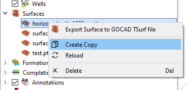
Create a copy
You can easily create a copy of an existing surface by choosing Create Copy in the surface right-click menu. A new, identical surface will show up at the same level in the project tree. You can now give it a new name, change depth offset etc.
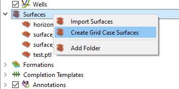
Grid Case Surfaces
In addition to importing surfaces from file, ResInsight can also generate grid case surfaces. You do that by bringing up the right-click menu for the
project tree entry and choose Create Grid Case Surfaces.
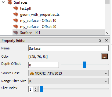
A grid case surface has the same properties as a surface imported from file, but instead of choosing which file the data should come from, you choose a source case, a slice direction and a slice index. The slice direction and index will be added to the surface name shown in the project tree.
Depth Surfaces
A flat surface at a specified depth can be created from the right-click menu and select Create Depth Surface. A transparent surface is created, and color and transparency can be adjusted.
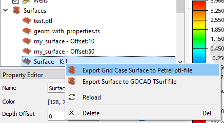
Exporting Surfaces
ResInsight can export surfaces to the GOCAD TSurf file format. Grid case surfaces can additionally be exported to Petrel Surface PTL format. Use the right-click menu for the surface you want to export and choose the export format you want to use. A file selection window will show up allowing you to choose where you want to save the exported data.